Doing the track thing

While preparing for the TAT ride, I’ve been creating gpx files containing trackpoints for navigation.   However, the Garmin Nuvi 760 doesn’t know what to do with a gpx file containing trackpoints, so it just ignores it.   When uploading the file to the gps, it tells you that the upload was successful, but it wasn’t.   The file isn’t there.   That’s annoying.   If the upload process is smart enough to determine that it can’t   handle files containing trackpoints, then it’s also smart enough to tell me that it can’t handle them.   Sloppy (or lazy) programming seems to be the culprit here.

To use the handcrafted tracks on the 760, you have to convert them to routes.   I wrote a small script to do that (a gpx file is just an xml file with some special element names) and now the 760 accepts them and navigates the route without complaint.

But it isn’t a track, it’s a route, and gps devices like to recalculate routes to fit their own idea of how you should get from A to B.   With enough trackpoints (now routepoints) you can prevent that, but I shouldn’t have to.   I need a gps that understands, uses, and navigates TRACKS.

I found one and it seems to fit the bill in almost every way.   The unit is the DeLorme PN-40.   Most everything that Garmin does to annoy it’s customers, DeLorme handles better or just avoids the problem in the first place.   What do I mean?   I mean having to buy (or find on the net) the program to create routes on your pc/mac and then upload them to the gps.   I mean having to use an unlock code to make the maps work.   Hopefully you’ll never have a pc/mac computer fail, or have to replace a hard drive, because you’ll have to pony up for a new unlock code to use the maps you already bought.   You can install the maps on multiple laptops, but what if you have more than one gps?   This unlock code, serial number checking crap is a real annoyance to customers.   Do you hear me Garmin?   What if you lose the gps itself?   On the trail that is a distinct possibility.   So, that’s not Garmin’s fault.   But you can’t use the maps on your laptop because they’re unlocked only to one gps – the one you lost.   And the cycle starts over – if you let it.   OK, rant over.

I’m not going to buy a DeLorme for the first part of the TAT trip, because it doesn’t make sense to switch navigation devices this close to departure.   But for the western TAT next year, count on it.   Garmin has seen the last $ from me.
Prep for the trip

The departure date is almost here, you can smell the anticipation in the air.  OK, well, to be truthful the odor is probably solder smoke, oil, rubber, and more than a little sweat (it’s been in the 90s here).

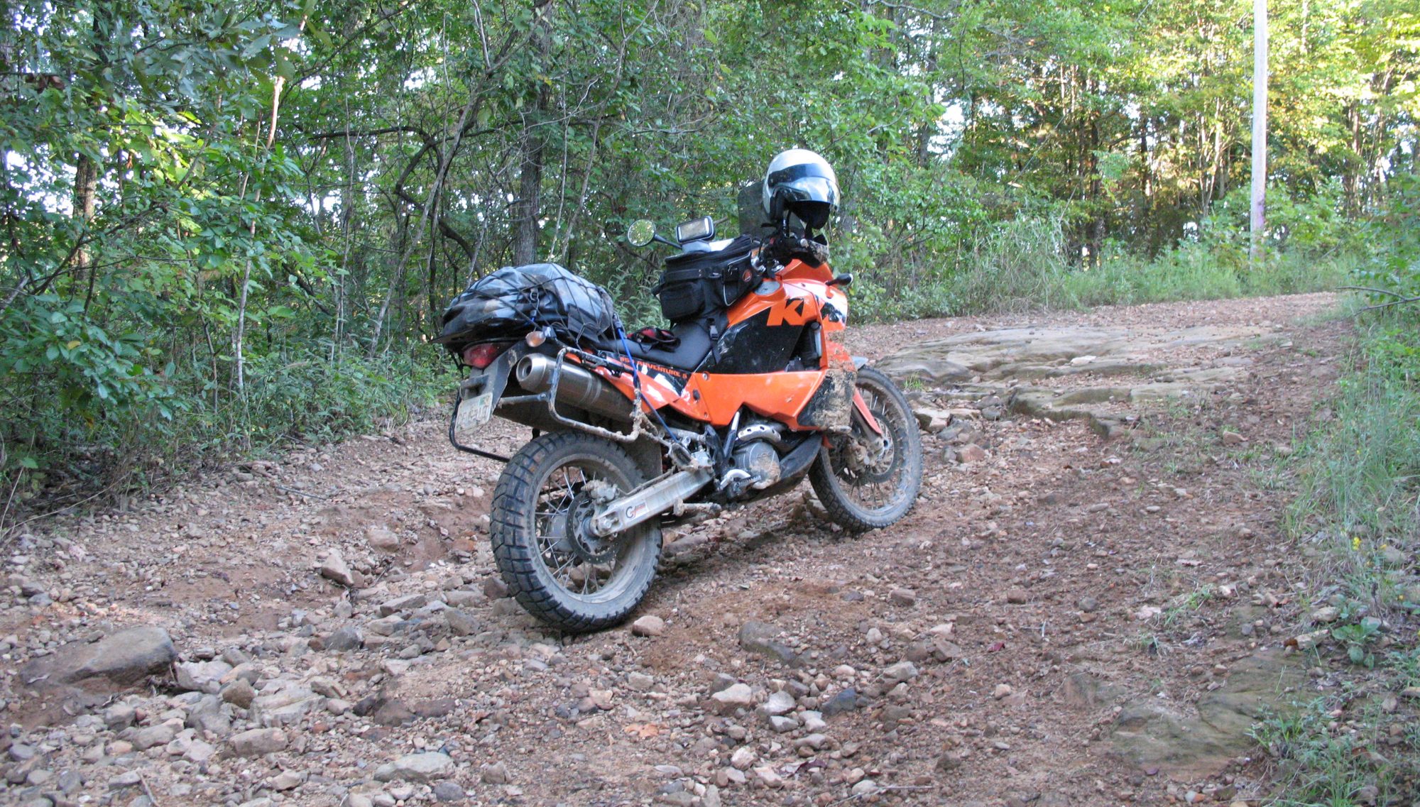
The bike is ready.  It just needs a bath but other than that it’s ready to go.

There is other prep to be done.  We’ve made gps tracks from the paper maps and have planned our route from the beginning in Tennessee to the end in Trinidad, Colorado.  Depending on several things, primarily weather and time, we have three places where we will call it a trip and head for home.

The trip looks to be approximately 2100 miles of trail riding, with an additional 1500 or so thrown in to get to the start and to get home afterwards.  That’s a lot of riding to do in a week (plus a couple of days if necessary), so there won’t be much lollygagging around.

I have grand plans to document the trip with photos, maps, and some writing – hopefully I can manage to do all of that and enjoy the riding, companionship of my good friend John, and the best part of all – being smack-dab, plumb in the middle of a genuine adventure of our own making.

This is also the shakedown trip for the western TAT that we are planning for next year. We’ll figure out what works, what doesn’t, what we didn’t need to take, and what we should have brought along. We should have our kit well sorted for next year’s adventure.

Stay tuned.

Two wheels without IC…

That’s right, no internal-combustion engine.  Those of you that know me are familiar with my enjoyment of internal-combustion power for two-wheeled vehicles.  Well, I’ve resurrected a very enjoyable hobby from my past, riding bicycles.  I rode a LOT as a teenager living in upstate New York, but no so much lately.  It turns out that my bride enjoys riding and we can do that together which makes it even better.  The exercise is beneficial, of course, but that’s not the only benefit.  We get to use some nice bicycle trails in the area and we can spend some quiet time together away from the computer, television, and telephone.

Unplugging is becoming more attractive as time goes on.  Stay tuned as we visit bicycle shops looking for bikes – the ones we’re using now are almost 20 years old (in my case) and the other isn’t even hers (it’s her daughter’s bike).

It’s time to fix that.