Eastern TAT – post mortem

The short version is that our planning was very good, but some changes will make it even better.

Navigation: Making tracks using the paper maps and then converting them to routes for use in the Nuvis worked very well. No real changes necessary here. It would be better if we could mark the fuel stops so that there was an alert when you are close, but that’s about it.

Tools: We had the tools necessary. John patched a screw hole in his rear tire using the tools he brought. I didn’t have any flats, but I had the necessary tools and the air compressor ready to go. My new username of DirtNap was earned, and the bike’s mirrors survived. The threads loosened just as they should have and there was no damage to the mirrors from any of the naps. It seemed like I was tightening them a lot, but I had the tools and it was nothing more than a minor nuisance.

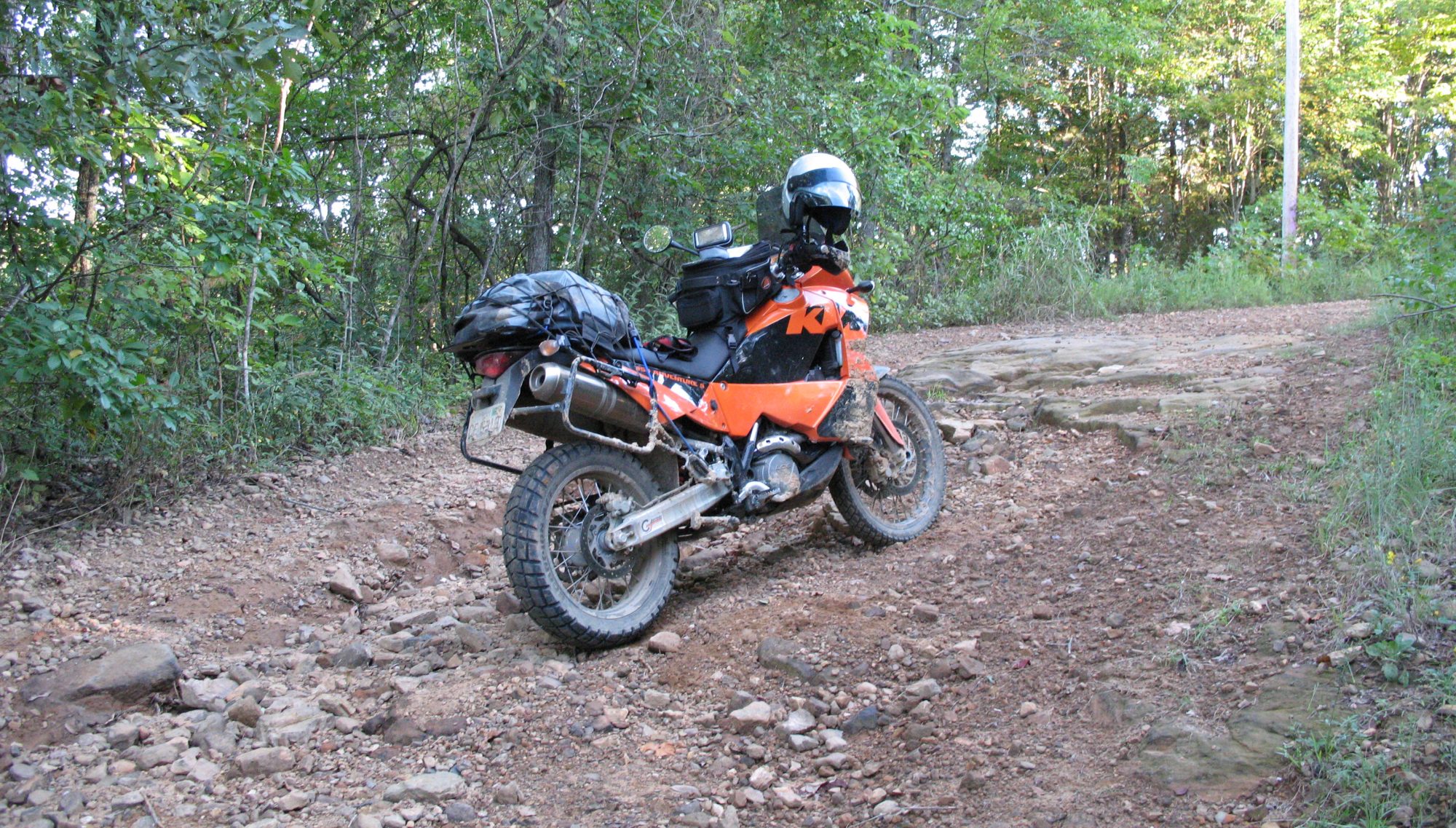
Luggage: We packed fairly light, but the duffels weren’t light. I would guess 30-40 pounds. Mine included the first aid kit, tool kit, air compressor, spare tube, computer, clothes, toiletries, shoes (sandals and slip-ons), and jacket liner. In the tankbag I had my iphone, camera, earplugs, ipod, earbuds, paper maps, windshield / faceshield cleaner and diaper, eyedrops, charging cables, cable lock, headband flashlight, and tire pressure gauge.

Changes for the next trip:

Luggage / packing: It would definitely help to get the weight down to lower the center of gravity, so I think waterproof soft saddlebags will be the choice for next year. I probably will carry pretty much the same items in the tankbag. We are planning to camp next year, so that adds some items to the list. Tent, sleeping bag, pad, stove, food, and water will have to be carried with us.

Gear: I need to get a better jacket and pants. I wore kevlar-lined jeans and while they may help while sliding they provide no impact protection. I’m considering the Firstgear Kilimanjaro jacket and TPG pants. Regardless of the jacket I select, it definitely won’t be black. My current jacket is waterproof because of the liner, not the exterior shell. That means the jacket shell will be soaking wet in the rain. I would rather that the jacket shell be waterproof and the liner be used for warmth. It just works better on the trail. Same for the pants, a liner for warmth only.

I bought a pair of Aerostich Combat Touring boots before we left, but they needed to be resoled. That’s now done, so my boots are ready to go.

Misc: I’ll add a bottle of ibuprofen and benadryl to the first aid kit. It would be good to have some cotton handkerchiefs on the outside of the packs so that you can wipe your glasses and/or faceshield while riding in the rain (which happens a LOT when I’m riding). Maybe an easy way to attach them so they can dry in the wind would be useful too.

I’ll need to come up with camping gear too.

TAT day 6 – headed for home

Well, this was unexpected. Went to bed expecting to get up and hit the trail to Braman, Oklahoma but woke up to a line of strong thunderstorms in northern Oklahoma and south-central Kansas moving east. They had dumped a lot of rain directly on the secondary roads we would be on today. Not what we wanted to see. We had a couple of hundred miles to ride to get to Braman, and slogging through mud would make that seem like an insurmountable goal. Since we were going to Braman, just to head home the next day, we took another look at the weather and decided to head for home today. We’ll meet here next year for the ride to the Pacific, instead of meeting in Braman.

John saddled up and headed southeast, I headed northeast on I-44, trying to get ahead of the storm. The storm was tracking roughly parallel to I-44, and I knew that I would turn north after going through St. Louis. If I wasn’t far enough ahead, when I turned north I would get caught and get seriously wet for a while.

I made fairly good time, and came through St. Louis around 3pm, leaving 5 hours or so for the rest of the trip. We had just visited Dave and Lynn in St. Louis, so I was confident in the 5 hour estimate. I stopped for gas in Springfield, and it looked like the rain was beginning to cover my route. Unfortunately, the look was right. I was soaked through until I got north of Champaign. It had changed to a drizzle and then stopped shortly after my last gas stop. I got home around 8pm, after a 12 hour day on the road.

Let’s just say the KTM seat isn’t made for long distance riding, and over 600 miles in a day on the KTM was definitely a long day’s ride. I got home after dark, again not my first choice, but home was a powerful draw. I hadn’t seen my wife Amy for a week and I missed her.

I’m glad to be home and I’m also glad John and I rode the eastern part of the trail. Next year, we’ll be better prepared and likely on different bikes for the western trail.

Stay tuned for the eastern TAT post mortem.

The stats from a long day in the saddle:

TAT day 5 – Tuesday

Today we had approximately 100 miles to go and we would be at the Oklahoma border. It would turn out to be some challenging miles over some terrain made more difficult by the weather.

I love the way paved roads become gravel at any time. We’re on a fully striped two lane highway, and then the sign “Pavement Ends” and end it does. Just as we start up the mountain. In the rain. In the harder rain. With lightning. And thunder. Great. Arkansas just won’t let us have an easy day. Oh, well, we aren’t giving up either. We just stayed on the trail, stopping a few times to clean glasses and face shields so that we can actually see the trail we’re riding. In some places the runoff has washed out some good-sized ruts in the road, so you have to really watch the road.

Eventually, we get over the mountain and onto the more level ground. As we cross into Oklahoma it begins to rain harder and John spots a church with a porch that we can tuck under for some shelter. We see the rain on the iphone weather radar, and it looks to be moving to the southeast, leaving us clear skies but wet roads. We head out and almost immediately find mud, but it’s not nearly as bad as we’ve seen and the roadbeds seem to (mostly) dry out rather than turning into a mudfest. That’s good news.

Then, we see a single motorcycle headlight coming at us. The first TAT rider we’ve seen, moving west to east. It is Brienne (Grlstar on ADVRider) on her KLR650. Soon after that, Ted (tcourdin on ADVRider) comes up on his GS1200. He’s from Fayetteville, not too much further down the trail. We talk for a few minutes, take some photos, say goodbye, and continue on our way.

A few miles down the trail, John turns right, but I need gas and the map says Moody’s is a little over a mile away. he doesn’t turn around, so I go on to Moody’s, fill up, and head back to pick up the trail. A couple of miles down the trail, he’s waiting and he’s found a Best Western in Locust Grove. It’s been a longer day than either of us expected and we take a odd route to the hotel, but at least we found it. Dry clothes, a hot shower, a hot meal – they seemed a long ways away when the rain was pouring on us as we started UP the mountain in Arkansas.

The stats from today:

TAT day 4 – Monday

Today’s highlight was the General Store in Oark, Arkansas. This is a must-stop for any and all TAT riders. Apparently the owner is into dual-sport riding and is supportive of the TAT riders. Gas, a good meal, and a slice of pie in a unique setting is a welcome respite from the trail. This was to be a fairly low-mileage day, but the miles were not easy ones.

The trail gods were at it again. “Nope. Too fast again. Why don’t you take White Oak Mountain Road?” Rocks, rock ledges, narrow roads, and great vistas were all thrown together. John and I got separated and we decided to meet where the trail joins AR-123, but he wasn’t there when I got there. I waited a while (no cell coverage) and decided to ride down the road to where the trail leaves AR-123. Not there either. I was just about to go back and ride up the mountain to get cell coverage and call him when I heard the unmistakable sound of a BMW boxer. While we were figuring out our next move a logging truck came by, just under the speed of sound. Man, those guys can really move.

After getting beaten up on White Oak Mountain road, we decided to pass on Warloop road and headed on into Alma for food, gas, and a place to sleep.

At least we didn’t have to slog through any mud today.

On the replacement bike front – I came to a decision today. I’m changing bikes. I put a deposit on a 2007 BMW F650GS with a factory lowered suspension. As soon as I’m back home, I will clean up the KTM and put it up for sale. It’s a great bike, but not a great bike for me.

The stats from today:

TAT day 3 – Sunday

After having earned our Mud merit badges, and a new username of DirtNap, I had high hopes for today and the weather looked really good.

The roads were (initially) fairly dry gravel in good shape and we could make good time. True to form, however, it didn’t take long for the trail gods to say “Nope. Too fast. How about some mud right HERE?” The trail gods were serious. This was the worst mud we had encountered and since you can’t tell when it will end, you carry on. The road was running alongside a creek that had been out of it’s banks very recently and the road was berm-to-berm mud. My favorite. Red, slimy, sticky and slippery. After rolling a few feet the bike is taller because of the mud stuck to the tires. After putting your feet down a few times you’re taller as well – for the same reason.

We slogged on through 4-5 miles of this and finally came to a turn onto a paved road. Right there we decided that we were going to bypass the next mudfest we encountered, as our Mud merit badges had been earned many times over.

The terrain was starting to change too. More hills and less bottom land. But at the same time, the hillsides and roads are becoming more rocky with exposed ledges and big rocks.

Now we’re getting into the Ozark National Forest on the fire service roads. These roads aren’t in the best shape and are usually narrower than the county roads. After passing a ranger station, there was a switchback and a rocky and steep climb. Picking your line on this type of trail just about requires that you are up on the pegs, looking ahead and once chosen, committing to the line. Throttle and clutch control will help avoid wheelspin and keep the rear tire hooked up. I got the KTM a good part of the way up and chose a line to the right, which turned out be a bad choice. John was able to back the KTM up a bit and get it over to the left side, which was clearly the better choice.

In the Ozark Mountains the scenery (when there was an opportunity to look around) was really nice. You have to concentrate on the trail, because the margin for error is pretty thin when you are a long ways from help. Some of these roads don’t see traffic except for TAT riders, so waiting for help is futile. We both have SPOT trackers, so we can summon help even without cell coverage, but it seemed better to avoid the need to summon help in the first place.

We decided to stay in Clinton, Arkansas, and John saw an opportunity to head for Clinton that saved us a few miles today and tomorrow when rejoining the trail. We stayed at a Super 8 and were both able to get laundry washed and dried. We had intended to bring enough clothes for 3-4 days of riding and then to wash them and have enough for the rest of the trip. So far, other than the miles per day, our planning was working out well.

While we were riding today, I mulled over this thought – is the KTM the right bike for me? Given the past couple of days, I’m thinking no is the honest answer. There may be a replacement that is a better fit – but I need to do some research before making a decision.

The stats from today:

TAT day 2 – Saturday

Slightly surprised by the number of miles ridden yesterday, we got going early as we were about 15 miles from the trail in Ripley. We stopped for gas on MS-15 so that we would start the trail with gas tanks as full as possible. Today looks to be wet and rainy (big surprise) but so far the skies have held off – no rain. I expect that today will be a lot of gravel and mud, with little pavement in the mix.

Well, it didn’t take long to find out about riding on slippery red mud. To be slightly more accurate, it didn’t take long to find out how NOT to ride on slippery red mud. Mainly as a result of today’s ride, I will change my ADVRider username to DirtNap. I can state with certainty and experience that Scorpions are not great mud tires.

The real fun began at Tubby Bottom. The first indication that it’s going to be fun is the “bridge out” sign. Having read many TAT ride reports we knew that it isn’t really out, it’s just sort-of out. I’m hoping that yesterday’s rain wasn’t going to make it really out, and it did not. First you ride over a couple of feet tall mound of dirt and then across a concrete slab “bridge”. Now, you can see the actual place where the bridge ought to be – but it isn’t there. What’s there is a shipping container dropped into the creek. The doors are open on each end and the creek is flowing through the container. It was used as a bridge by at least one vehicle that exceeded the container’s weight limit, because the top was caved in. Both ends were still straight, but one end was unreachable due to erosion around the container. The other end had dirt piled against and across it and it was rideable. John rode his GS1200 across easily and because I couldn’t count on getting my feet down in an emergency, he rode my KTM across too. Better safe than in the creek underneath a KTM. Actually not nearly as difficult as I first thought. As it turned out, I should have kept that thought to myself.

Getting into Tubby Bottom was much easier than getting out. Slimy red mud was the next challenge and we probably burned at least an hour of daylight to get 2 or 3 miles. Finally, we seemed to be out of the really bad mud section and we came to the often-photographed Mississippi water crossing. The bottom looked and walked pretty solid so I went first. It looked much harder than it was, but if the water levels were higher it could be a real challenge.

We still had some mud to deal with but we kept at it. We’re not going back, the only proper direction is forward. But, the mud really takes a lot out of you and it was good to see the river levees for the Coldwater River. Shortly after that we were in Arkansas and found a Best Western in Helena. A long day, a lot of work, and not nearly as many miles as we had hoped. But a suggestion of a good Mexican restaurant from the desk clerk resulted in a good, filling meal. Then I headed off to a hospital I had seen to get my finger looked at – it was swollen and very painful. The emergency room was backed up with the uninsured getting “emergency” care for their coughs due to cold, so I got some paper clips and a lighter to solve the problem.

The reality of actual miles traveled is setting in – Trinidad, Colorado is looking very unlikely unless we have several days of dry roads and can increase our moving average. Clearly my estimates of how many miles we can manage in a day is based on road miles and not on trail miles. They’re not remotely close.

The stats from today:

TAT day 1 – Friday

For us to make it to Trinidad, Colorado in the time we’ve got, we need to put some miles behind us. We were up without waiting for the alarm, had a moderately bad hotel breakfast and some really bad coffee, and hit the road around 7am. We crossed I-65 and turned south on the trail, less than a mile from the hotel.

The roads were pretty good, some paved, some gravel, and some that used to be paved but are now becoming gravel. Of course, some roads are always being resurfaced and we located a few of those as well. Just as we topped a small hill, we found fresh chip-n-seal – more chip than seal. And, to make things even more interesting, at the bottom of the hill was a sharp left-hand turn. I could see that I wasn’t going to make the turn so I braked, let off, braked, let off, braked but the rear tire slid out to the right and I low-sided. Banged my knee on the road, smashed my left-hand ring finger, and banged by helmet on the road. Gear is good – gear that you’re wearing when you need it is priceless. The bike came through it unscathed; I wound up with a sore finger and knee. I’ll be even more careful topping hills and rounding curves in the future.

We found several water crossings, something I had not done in a number of years. From reading TAT reports I knew that at least one was notoriously slippery and I think that was the first one. John slipped and slid as he crossed, and we walked my bike across. When the water is clear you can more easily pick a good line, and it seemed that the water levels were down compared to some photos I have seen.

If you’re hungry and find yourself in Olive Hill, Tennessee, you won’t starve. There’s a small country store that has burgers and drinks and a very nice lady running the place. It doesn’t look to be too busy so stop in and say hi as you pass by.

I have some experience riding in the rain, and it seems that all I need to do is to put on a riding jacket and take the bike out of the garage. Very shortly thereafter, any droughts in a 1000-mile radius will vanish. I had decided that it was my Goldwing rather than me that was the catalyst for rain. I was wrong. It is me. As we were eating at the Olive Hill store, some other folks stopped in and said it was raining in the area and that some of the rain was pretty heavy. Wonderful. Not only do I have a smashed finger and sore knee, but now I get a shower too.

The rain didn’t take long to find us, but for the most part we managed to avoid the heavier rain showers. That is, until we got close to the TN-MS border. It was really coming down, lightning, thunder, and strong winds. There was no shelter that either of us could see, so we just kept moving. When we were about to get into Mississippi, we broke out of the woods onto a ridge and the lightning was all around. This was not a good place to be but I figured a moving target would be harder to hit so we kept going. We finally descended off the ridge and got into Mississippi, where the sun was actually shining. We were soaked, and decided to break off the trail for a hotel in Ripley, MS.

A hot shower, some dry clothes, and dinner was a welcome respite. I don’t know how much the rain slowed us down, but I don’t think it was too much. Making 350 miles per day is going to be very difficult, and maintaining that average over several days is damn near impossible.

Here is the stats for the first day on the trail:

TAT – day 0 (getting to Tennessee)

The morning was chilly at o-dark-thirty, around 50 degrees. I decided to put on my jacket liner and wound up leaving it on until I was in Tennessee. No sense in being cold if you have the proper clothing. I had intended to leave at 6am, but didn’t quite make it, as usual. The bike was ready and packed, I was properly dressed, just took care of a few work things before I left and that’s me late. Rats.

There is a big difference between the full fairing on the Goldwing and the windshield on the KTM – 10-20 degrees worth is what I’m thinking. I have the Kaoko throttle lock, and it helps a lot on long stretches, but the Goldwing’s real cruise control seems “right”. Maybe it’s that the speed stays the same on the Goldwing, and it varies on the KTM as you climb and descend. Don’t get me wrong, the Kaoko is a big help and it works perfectly, but it’s not what I was used to. I did get more used to it as the miles rolled on. And on. And on. But I was meeting my good friend John for a genuine adventure and that thought pretty much erased any issues with the throttle lock.

I got to the hotel in Columbia, TN around 6pm, after being stuck in construction traffic at two different spots in two different states.

Here’s the results of day 0 – getting there:

Prep for the trip

The departure date is almost here, you can smell the anticipation in the air.  OK, well, to be truthful the odor is probably solder smoke, oil, rubber, and more than a little sweat (it’s been in the 90s here).

The bike is ready.  It just needs a bath but other than that it’s ready to go.

There is other prep to be done.  We’ve made gps tracks from the paper maps and have planned our route from the beginning in Tennessee to the end in Trinidad, Colorado.  Depending on several things, primarily weather and time, we have three places where we will call it a trip and head for home.

The trip looks to be approximately 2100 miles of trail riding, with an additional 1500 or so thrown in to get to the start and to get home afterwards.  That’s a lot of riding to do in a week (plus a couple of days if necessary), so there won’t be much lollygagging around.

I have grand plans to document the trip with photos, maps, and some writing – hopefully I can manage to do all of that and enjoy the riding, companionship of my good friend John, and the best part of all – being smack-dab, plumb in the middle of a genuine adventure of our own making.

This is also the shakedown trip for the western TAT that we are planning for next year. We’ll figure out what works, what doesn’t, what we didn’t need to take, and what we should have brought along. We should have our kit well sorted for next year’s adventure.

Stay tuned.